|
| Overview | Site Context | Examine the Site | Timeline |
44JC308 in Context |
|
|
The site is located on the east bank of the Chickahominy River one-third of a mile north of its confluence with the James, an area identified by Captain John Smith as belonging to the Paspahegh Indians, a group subject to Powhatan. The Paspahegh were one of at least 31 named, territorial groups within Powhatan's territory, all but one of which (the Chickahominy) were subject to Powhatan at 1607. The names and locations of the 31 groups can be viewed here. |
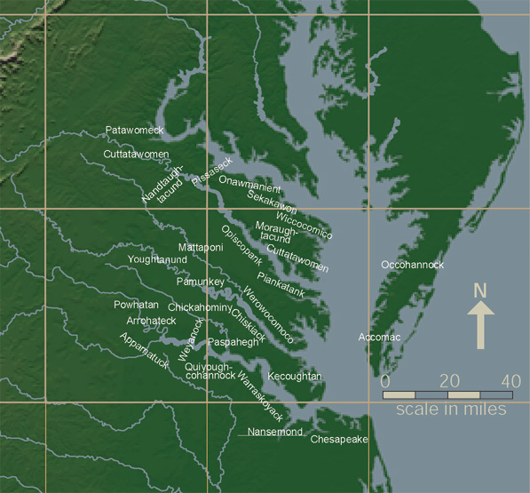 View larger version of petty chiefdoms map |
|
Both Smith's map of 1612 and the Zuniga map (believed to be a copy of Smith's 1608 map sent by the Spanish ambassador to the English, Don Pedro de Zuniga, to King Phillip III of Spain) indicate that the Paspahegh were settled along the north bank of the James, between Jamestown Island and the area west of the confluence of the James and the Chickahominy rivers. |
|
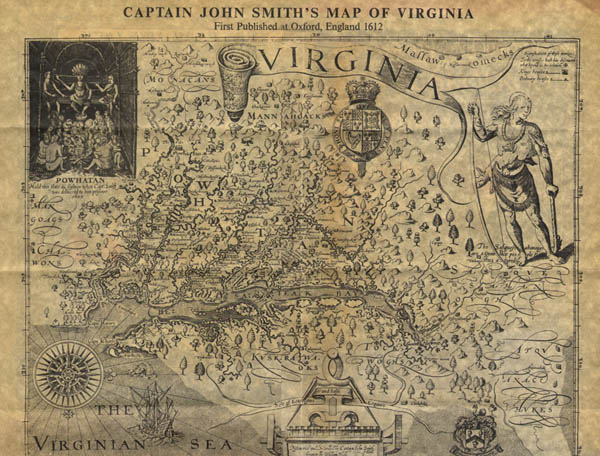 View larger version of Smith map |
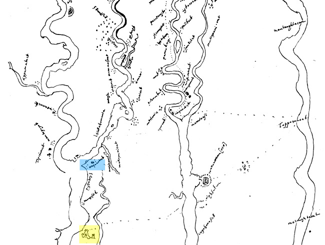 View larger version of Zuniga map |
|
Their location at the confluence of these two important rivers is likely responsible for the name "Paspahegh," believed by linguists to be Algonquian for "at the mouth of [a stream]" (Rountree 1989:11). Smith's 1612 map shows two villages east of the Chickahominy, one of which may be labeled "Matapanient." The two villages are labeled Namqosick and Cinquaoteck on the Zuniga map. Smith's map also shows three villages west of the Chickahominy-James confluence, including one "kings howse," the residence of the chief of the Paspahegh. Nearby settlements include Chickahominy villages further along the river of the same name and villages directly across the James from the Paspaheghs inhabited by the Quiyoughcohannock. |
|